
Drone Inspections & Imaging
Some areas are difficult, dangerous, or time-consuming to inspect.
Drone technology allows us to safely capture high-quality images and data without putting people at risk or slowing down operations.
What are Drone Inspections?
Drone inspections use aerial and confined-space drones equipped with cameras and sensors to capture images and video in hard-to-reach areas.
This allows inspections without:

Climbing

Scaffolding

Shutdowns

Confined space entry (in many cases)
Why It Matters
Traditional inspections can be time-consuming, expensive, and risky.
With drone inspections, you can:
- Improve safety
- Reduce inspection time
- Avoid unnecessary downtime
- Access difficult areas
- Capture clear visual data
Real-World Applications
We are actively expanding our drone capabilities across multiple applications, including:
Confined Space Inspections:
- Tanks
- Silos
- Boilers
- Ductwork
Exterior Inspections:
- Roofs
- Structures
- Solar Panels
Mapping & Monitoring:
- Coal or material stockpile mapping
- Site overviews
Recent Use Cases

Confined space inspection using drone to capture visuals without entry

Coal pile mapping to provide accurate visual and spatial data
Technology We Use
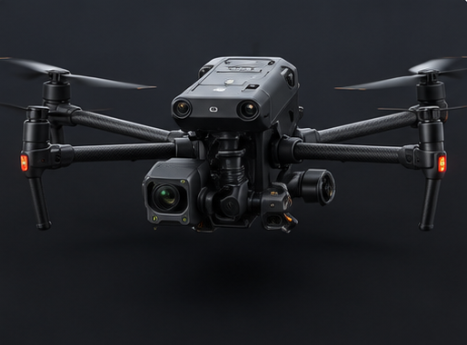
DJI M30T
(thermal and visual capabilities)
(thermal and visual capabilities)
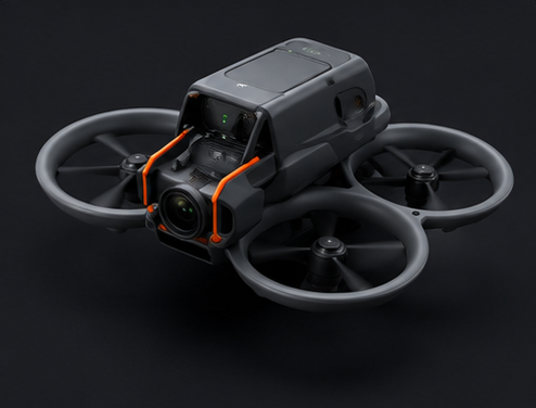
DJI Avata 2 (confined space inspections)
This allows flexibility depending on the environment and application.
Stronger Together
Drone services can support other diagnostic services by providing visual context.
For example:
- Supporting infrared thermography for large-area scans
- Providing visuals to accompany vibration or ultrasonic findings
This helps create a more complete understanding of equipment and facility conditions.
What Makes PMT Different
- Trained and certified drone pilots
- Focus on practical, usable results
- Safer inspections with reduced risk
- Clear visuals that support decision-making
Process
1
Call to schedule service
2
Site evaluation and planning
3
Drone inspection and data capture
4
Review of images and findings
5
Delivery of visuals and recommendations
1
Call to Schedule
2
Site evaluation and planning
3
Drone inspection and data capture
4
Drone inspection and data capture
5
Delivery of visuals and recommendations
When to Use
- Hard-to-reach inspection areas
- Unsafe inspection areas
- Need for visual documentation
- Desire to reduce downtime
